Flume Trail

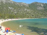
The Flume Trail at Lake Tahoe starts at Spooner Lake in the Lake Tahoe National Park, on the east side of Lake Tahoe (the Nevada side), and ends 13 miles later in Incline Village at the intersection of Tunnel Creek Road and Hwy 28. The trail takes about 4 hours to complete and is one of the West Coast's most popular mountain bike trails. The views of Lake Tahoe from the trail are incredible!
I love the video below, because it has combined video of the trail, along with GPS Technology and Google Earth:
Flume Trail Overview
- Trail Use: Primarily Mountain Bikers. Horses and Dogs are not allowed on the trail. Hiking is allowed, but after watching a bunch of video's of the single lane trail with a steep drop off in lots of places along the way, I would not personally want to be hiking the trail and run into a mountain biker.
- Length: 13 miles
- Parking - is available at Spooner Lake, but the best bet at the end, is to ride the Shuttle back to Spooner Lake. The cost of the shuttle is currently $10.
- Best time to ride the trail: June through October, due to potential snow on the trail in the other months.
- Bike rentals - are available at Spooner Lake from Flume Trail Mountain Bikes.
Flume Trail Events
The X-Terra Lake Tahoe is an annual event each year with a swim in
Lake Tahoe, followed by an extreme 22 mile mountain bike ride along the
Flume Trail and the Tahoe Rim Trail, finishing with a scenic trail run through Incline Village.
The 2024 event is being held on September 15, 2024 from 7:30am - 3:00pm.
Here is a great video of a group of riders training for the 2011 event:
Flume Trail Recognition
Below, I'll list some of the links with articles that have included the Flume Trail:
- San Francisco Chronicle - June 3, 2012 - 5 Hot Spots for Bicyclists (Flume Trail is listed as #3)
This was another great video that I found. Watching the video's of a trail before you go will give you an idea of what you are up against, and get a feel for the difficulty level of a trail. On this one, I could do a lot of it, but I think my fear of heights would keep me from being able to do the single lane parts right on the edge.
The video below is great also - it seems like they showed lots more of Lake Tahoe which just looked incredible. They also had more views looking down over the edge, which shows you just how high you are on the mountain, and just how narrow the ledge you are riding on is. I must admit that it looks super fun, and I'm in awe of anyone that can do this!
Resources:
For more information about the trail:
- The Flume Trail - http://flumetrailtahoe.com/
- Nevada State Parks - Spooner Backcountry
Like This Page?


Please Check out my other Websites!

Healthy Diet Habits:

Holidays and Observances
U.S. and World Holidays - Over 6,000 so far!
Related Pages


This page has links to all the Lake Tahoe Cities & Towns and State Parks


Solo Build It is the E-Business Software I am using for this site (and 3 others!) - with a Step-By-Step process of creating a website and making passive income! In this economy, it's a great idea to have multiple income streams!
Go to Truckee Summer Activities
Return to Truckee Mountain Biking
Return from Flume Trail to Truckee Travel Guide Home Page
